The Akdoğan Mountains: A Volcanic Landscape and a Hundred Lakes on the Border of Muş and Erzurum
The Akdoğan Mountains (Turkish: Akdoğan Dağları, sometimes Hamurpert Dağları; Kurdish: Çiyayên Xamirpêtê; Armenian: Hamur or Hamurpert) are one of the least known natural sites in Eastern Anatolia and, at the same time, one of the most unusual. These low-lying but densely packed volcanic mountains are situated precisely at the zero point of the border between the provinces of Muş and Erzurum and stretch in a narrow strip just 30 kilometers long and 10 kilometers wide. Within this small stretch, the Akdoğan Mountains are home to more than a hundred small lakes, the crater lake Akdoğan-Gölü, the region’s most important bird wetlands, oak groves, meadows of Turkish peonies, and flocks of partridges—in short, an entire alpine nature reserve in miniature, still largely undiscovered by tourists.
History and Origin of the Akdoğan Mountains
Unlike ancient cities or medieval fortresses, a mountain range has no “date of foundation”—only a deep geological history in which human chronicles barely occupy the last paragraph. The Akdoğan Mountains belong to the young volcanic belt of Eastern Anatolia, and almost their entire relief was formed as a result of volcanic eruptions: it was precisely after these eruptions that the erupted rocks cooled in the craters, gradually filled with rainwater and meltwater, and transformed into the very crater lakes that today constitute the range’s main feature.
Geomorphologically, the Akdogan Mountains appear as a distinct mountain massif, sandwiched between the Hynis Plain to the south and the Murat River—the largest left tributary of the Euphrates—to the north. Most of the slopes are composed of volcanic rocks, but limestone layers break through in certain areas; this mixture is what creates such a unique hydrological landscape—on a single mountain, crater lakes of volcanic origin coexist with small karst basins fed by underground springs.
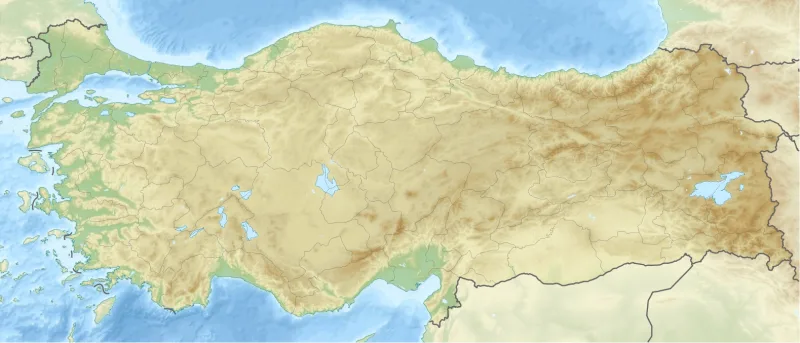
Administratively, the massif belongs simultaneously to two provinces—Muş and Erzurum—and three districts whose borders intersect directly in the mountains: Varto, Bulanyk, and Hınıs in the west, and Karachoban in the east. The eastern tip of the massif extends to the Karachoban district, while the western tip reaches the shores of Lake Akdogan-Golu. This borderline nature partly explains why few people outside the region know about the Akdoğan Mountains: neither province considers them “its own” main natural attraction, and the range remains in the shadow of the more famous Nemrut, Süphan, or Tendürek.
The linguistic history of these mountains is no less interesting. The local population calls them by various names: the Turkish Akdoğan Dağları (“Mountains of the White Falcon”) or Hamurpert Dağları, the Kurdish Çiyayên Xamirpêtê, the Armenian Hamur or Hamurpert—and in each name, one can hear the cultural layer of the people who have lived at their foot for centuries. The fact that the same place has several names is the best reminder of just how multi-layered the history of Eastern Anatolia was and remains.
Architecture and What to See
The main reason to visit the Akdoğan Mountains is not a single peak or a single route, but the landscape itself: a broad mountain range 30 kilometers long and 10 kilometers wide, where the scenery changes literally every hundred meters. One minute—meadows dotted with ferula umbels and eremurus spears; another minute—dark oak groves; yet another minute—the blue mirror of a crater lake comes into view, its shores dotted with motionless herons. This is one of the best-preserved natural areas in the province of Muş and one of the main destinations in Eastern Anatolia for those who know how to read the landscape.
Crater Lakes and Wetlands
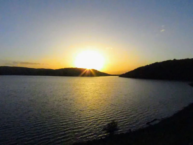
The jewel of the massif is Akdogan Golu, one of Turkey’s highest and best-preserved lakes. In addition to it, the massif contains over a hundred small, shallow lakes; most of them are concentrated around the villages of Hynis, north of the unnamed 2,879-meter peak. These bodies of water form one of the region’s most important wetlands for migratory and nesting birds—birdwatchers here have plenty to keep them busy for days on end. The Akdogan crater lakes were formed as a direct result of volcanic eruptions: the basins left behind after the lava cooled filled with water and, over time, took on their characteristic rounded shapes. The northern part of the massif is particularly picturesque, where dozens of small bodies of water are scattered among the hills, literally within sight of one another—it’s unrealistic to cover all of this on foot in a single day; it’s better to choose a central lake and explore the area around it with radial excursions.
The peaks of Göztepe and Hızırbaba and the view of Süphan
The range’s main peaks are Göztepe and Hızırbaba; they are among the highest in the province of Muş and also serve as ideal vantage points. On a clear day, the cone of Süphan—a four-thousander and Turkey’s second-highest volcano—is clearly visible far to the southeast. A paradox: even from the lowest parts of the region, Süphan is clearly visible, and the entire Akdoğan massif seems to live in its constant presence—just as the Ural Range lives in the sight of distant Mount Narodnaya.
Forests, meadows, and the Turkish peony
The flora of the Akdogan Mountains is a small encyclopedia in itself. This is one of the few areas in the province of Mus with relatively “organized” forests: oak groves are interspersed with groups of Crataegus monogyna (common hawthorn), Malus sylvestris (wild apple), Pyrus elaeagrifolia, Prunus mahaleb (Mahaleb cherry), rose hips, Aria edulis, and Cotoneaster nummularius. In the meadows, Eremurus spectabilis (ereumur), Paeonia turcica (Turkish peony), Astragalus kurdicus, Gundelia, sorrel, chicory, thyme, and Eryngium billardieri bloom in early summer. A special feature is the two species of ferula—poisonous and non-poisonous—and the mushrooms Pleurotus eryngii var. ferulae, which grow on its rhizomes in virtually every corner of the mountains. This ferula oyster mushroom is considered one of the best wild mushrooms in the region.
Fauna: bears, lynxes, and jerboas
The list of wildlife is also impressive: the slopes of the Akdogan Mountains are home to brown bears, wolves, foxes, wild boars, partridges, lynxes, ducks, turtles, Williams’s jerboas, Caspian tortoises, and European green lizards. For seasoned wildlife observers, this is a rare chance to see a jerboa and an Anatolian lynx practically on the same route; for the casual traveler, it’s a reason to be cautious around bears, which come down to the damp shores of the lakes in search of berries as August approaches.
Interesting Facts and Legends
- The Akdoğan Mountains bear four names: the Turkish Akdoğan Dağları (“Mountains of the White Falcon”), the second Turkish Hamurpert Dağları, the Kurdish Çiyayên Xamirpêtê, and the Armenian Hamur (Hamurpert). This is a rare case where different peoples have preserved the same geographical feature in their toponymy under completely different names, and each of these names is still used by the local population to this day.
- The massif, just 30 kilometers long and 10 kilometers wide, contains more than a hundred small, shallow lakes—a density comparable to that of the Finnish lake plateaus. Most of them were formed by volcanic eruptions: craters left behind after the lava cooled filled with rainwater and meltwater and turned into crater lakes, the main one of which bears the name of the massif itself—Akdogan-Golu.
- A special subspecies of oyster mushroom—Pleurotus eryngii var. ferulae—grows here on ferula rhizomes and is found literally in every part of the mountains. In global cuisine, this mushroom is considered a gourmet delicacy and is valued on par with white oyster mushrooms, but in Eastern Anatolia, it is still harvested for home consumption rather than for the market.
- Among the inhabitants of the Akdogan Mountains is an animal with a very rare “surname”—Williams’s jerboa. Its range within Turkey is extremely limited, and Eastern Anatolia is one of the few places where observers have a chance to encounter it in the wild.
- Even from the lowest valley of the massif, the distant cone of Süphan—Turkey’s second-highest volcano (about 4,058 m)—is visible. This visual landmark has made it a natural reference point for travelers and shepherds throughout the ages—from the Hittites to the modern Yuryuk nomads, who spend the summer months here with their herds.
How to get there
The Akdogan Mountains lie at the junction of the provinces of Muş and Erzurum, deep in Eastern Anatolia—this is one of the most remote corners of Turkey from Istanbul. The most convenient way is to fly to Muş Airport (Muş, code MSR) or to Erzurum (Erzurum, code ERZ); There are regular domestic flights from Istanbul to both destinations, with a flight time of about two hours. From Muş to the foot of the mountain range, it takes about one and a half to two hours by car or minibus via Bulanyk and Hynis; from Erzurum, the route is slightly longer and goes through Karayazı and Karachoban.
It’s difficult without your own transportation: public transit only goes as far as the regional centers of Varto, Bulanyk, Hynis, and Karachoban, and from there to the trails and shores of Lake Akdogan-Golu—you’ll need a taxi or a ride. Most tourists rent an SUV at the airport: the roads in the mountain range are mostly dirt roads, and not every passenger car can handle them in the rain. In case of fog or a sudden thunderstorm, it’s worth having a paper map with you—cell service in the mountains is unreliable.
Tips for travelers
The best time to visit is late spring and early summer (late May–June), when the snow has mostly melted but the alpine meadows are still in full bloom: Turkish peonies and eremurus are in flower, and ferula spikes are rising. The second ideal season is September and the first half of October, when the oak groves turn copper-colored and the air is still dry and calm. In winter, the mountain range is completely buried in snow, and it’s best not to go there without proper preparation; in summer, especially in July and August, the days are hot, but the nights at high altitudes are already cool—you’ll need warm clothes.
What to bring. Comfortable hiking boots—there are many sections of loose volcanic soil and marshy lake shores; insect repellent and sunscreen; a supply of water, because while the water in the high-altitude lakes is clean, it’s best not to drink it without filtering it; binoculars for birdwatching and viewing the distant panorama of Syuphan; a telephoto lens if you’re interested in wildlife. A tent and sleeping bag if you plan to camp overnight—there are no standard mountain huts in the area, and most hikers set up camp near the water.
What to combine it with. The route’s natural neighbors include Nemrut Gölü (a crater lake in the caldera of Mount Nemrut near Tatvan), the Süpahan massif, Lake Van with its historic Armenian churches on the islands, and the city of Muş itself with its old mosques and fortress. For birdwatchers and botanists, this is a rare chance to see Eastern Anatolian nature in its pristine state, free from mass tourism. The Akdogan Mountains are a destination for those seeking silence, clear skies, and that very sense of “the edge of the earth” that is no longer to be found in Turkey’s more popular tourist spots.